News   Apr 03, 2020
 4.8K     1 
News   Apr 02, 2020
 6.6K     3 
News   Apr 02, 2020
 3.8K     0 

Urban Development and Proposals Discussion

What’s your analysis of the Matco lands at Westbrook? It would appear to be “quality TOD supply” but it has not resulted in quality TOD. Is it just the vagaries of one developer and one deal that doesn’t point to any larger trend?
Hard to say - one-off deals create unique site economics that would over-ride any of my surface-level amateur analysis. I have no idea if this deal is also wrapped up in the park-and-ride/parking minimum mess that exists in all the other station areas. I am sure someone knows more than I about specifics about why Matco has failed so far to get anything going.

From a demand side, I would say that Sunalta, Westbrook and Shaganappi Point are seeing plenty of apartment demand with infill occurring and many more proposed. Examples include towers in Sunalta, Truman's 33rd Street SW proposals, a cluster of generic apartments at Shaganappi Point - again, nothing Vancouver-scale, but certainly not zero and many aligned specifically to TOD areas.

Looking more broadly, the inner SW (including areas along the West LRT) is seeing strong ongoing demand for infills almost everywhere - lots of that is the small-scale duplex/townhome stuff, but some will materialize as apartment demand. It has to - there area is increasingly popular and not everyone can afford a $1M infill in Killarney. It's too bad the whole area wasn't already up-zoned for small apartments - then we could save time and money on all the spot, incremental stuff when demand materializes at a station.

Here's a few more comments:
  • 45 Street - is a really low hanging fruit, with R-1 immediately south of the station, but it's further out and away from the action so demand is likely low in the short-term. That said, they should have up-zoned much further away from every station when the LRT was built so when demand materializes it can be supported easier in the future.
  • Sirocco - fully in the post-2000s era suburban station thinking - low density car-oriented and park-and-rides. Everything around there was built in the 2000s so redevelopment is still a while away until things hit their lifecycle.
  • 69 Street - a major miss. Fell into the trap as many other stations in the system - a cluster of a few institutional uses, combined with major road expansion and low density everywhere else. Demand for density obviously now exists on the hill with all the 85 Street W stuff, just wasn't there when the LRT was built. Instead of assuming future development potential, the West LRT assumed park-and-ride and the major road expansions was highest and best use. Together, that ensured nothing can redevelop nearby.
It's easy to forget that even though the West LRT was built in the late 2000s (when we should have known better) it still managed to pork up the project with a whole whack load of car-orientation projects bolted on that reduce the attractiveness of the TOD opportunities it built. So many road expansions throughout the whole corridor chipped away at the developable land, made things louder and uglier, and reducing the competitiveness of the LRT being built.

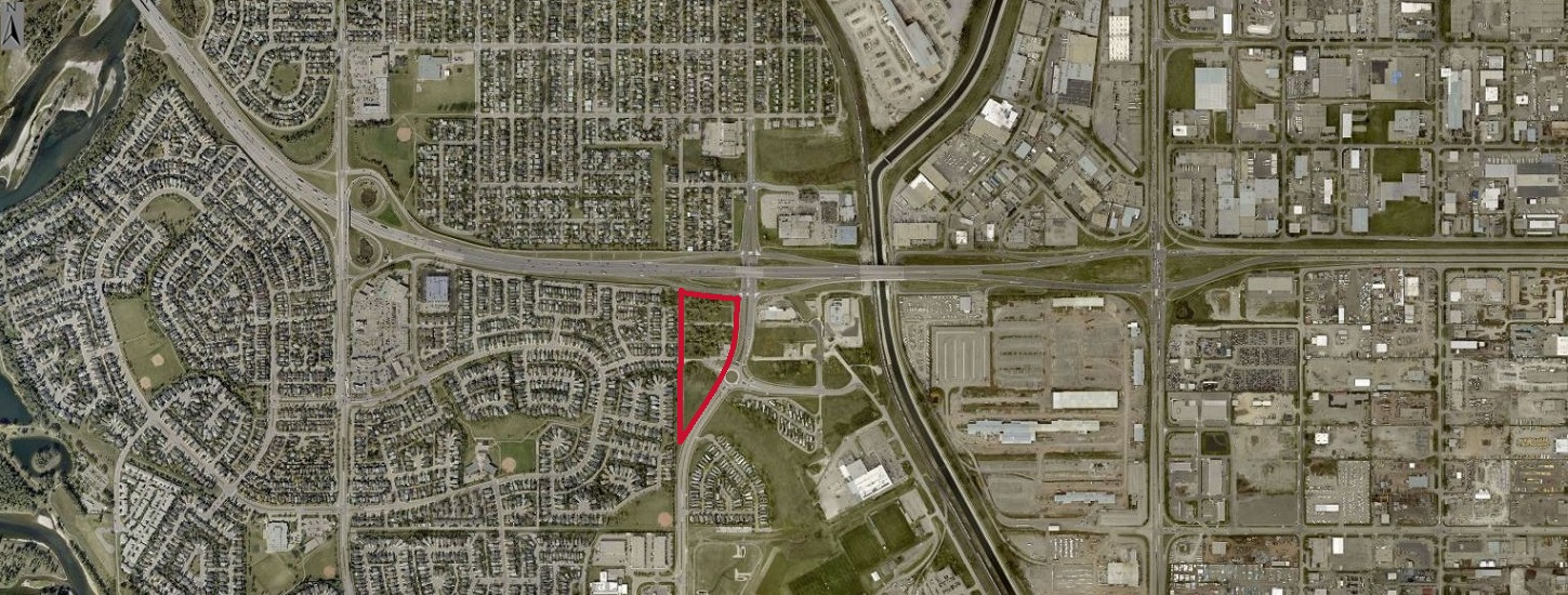
A good example is Bow Trail / 33rd Intersection 2006 (pre-LRT) v. 2021 (after LRT) - notable as it's a block from Westbrook and separates the high density areas to the north from the station that has seen substantial growth in the past decade or two. In best practice TOD form, the LRT project somehow triggered the widening of all roads, realigned to increase speed on Bow Trail through the curve at Westbrook, slip lanes, bus bays, dual-turns, increased crossing distances for pedestrians etc. all a half-block from the LRT station:

1668457129316.png
1668457161346.png


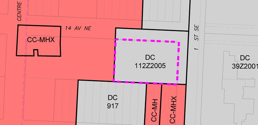
As for TOD, from the city's mapping site, we can see the land uses. Note the previous curve of Bow Trail is very much still visible, happily locked away into an unusable and pointless setback despite the road way shifting north and eating into the developable parcels to the north of Bow Trail.

A bit of a long-term play, but you'd think we would try to add the area circled in blue to the existing parcels so that when something eventually does get redeveloped here there's not this random sliver of land that's pointless and requires maintenance?

1668457653356.png


West LRT does better than others, but still has lots of room for improvement. Biggest land use crime(s) is the lack of density zoned for apartments (in general) and the aggressive road expansions near every part of the LRT system in the area that undermines much TOD potential.
 
Good post, and makes you wonder why The City would consider an application like Midtown, which would just pull apartrment demand away from our existing transit station areas.
I would turn that around....The City's incompetence, shouldn't block others from giving TOD a try. If Midtown gains momentum, building an adjacent Red Line station would be straightforward. Perhaps development in places like Westbrook has failed not only due to government bungling, but also due to non-market based competition from government backed ventures like East Village and West Campus. Government should be very reluctant to compete against the private sector, but it most definitely should not restrict the private sector from competing with it.
 
Potential fair point about Midtown, a lot would depend on who is paying for the cost of the new station, and what costs that will have on the operations of the existing line.

Since we are talking about TOD along these stations (which is great, there have been some excellent posts about it yesterday/today) I thought I would just remind everyone that RioCan did upzone their shopping plaza at Macleod and Southland (the one in the NW corner of the intersection where Safeway is (was?... I heard it closed?...)). Got Council approval on July 31, 2017. No idea if/when RioCan actually plans to move forward with development. Item 6.28 on this agenda:

Here is the report.
From the report:
1668465878370.png

1668465926815.png
 
Has anyone heard of any development plans for this parcel ? IBI has submitted a land use to apply for the following:
-allow for a mixed-use development in the Centre City Area
-no predetermined maximum building height - building height will be determined at time of development permit application
-a maximum floor area ratio (FAR) of 5.0 or 8.0, depending on the type of building, with exceptions for certain circumstances specified in the rules of the district
-the uses listed in the proposed CC-X designation

1668486789633.png
 
Also another land use submitted for this parcel. A FAR of 9 and 24,300 meters is a good sized building.

1668487018331.png


A change is proposed at 1401 1 ST SE to allow for: a Direct Control (DC) district based on the Centre City Multi-Residential High Rise Support Commercial District (CC-MHX) to allow for multi-residential development with the provision for stand alone commercial uses within the existing building; a maximum building height regulated by a Floor Area Ratio (FAR) of 9.0, including bonus density; a maximum building area of 24,300 square metres with bonus density achieved; and additional uses within the existing building.
 
Has anyone heard of any development plans for this parcel ? IBI has submitted a land use to apply for the following:
-allow for a mixed-use development in the Centre City Area
-no predetermined maximum building height - building height will be determined at time of development permit application
-a maximum floor area ratio (FAR) of 5.0 or 8.0, depending on the type of building, with exceptions for certain circumstances specified in the rules of the district
-the uses listed in the proposed CC-X designation

View attachment 439217

I believe that was one of the proposed sites for the hotel the Stampede is hoping to build. The other proposed site is the parking lot on the other side of Cowboys Casino to the west
 
Also another land use submitted for this parcel. A FAR of 9 and 24,300 meters is a good sized building.

View attachment 439218

A change is proposed at 1401 1 ST SE to allow for: a Direct Control (DC) district based on the Centre City Multi-Residential High Rise Support Commercial District (CC-MHX) to allow for multi-residential development with the provision for stand alone commercial uses within the existing building; a maximum building height regulated by a Floor Area Ratio (FAR) of 9.0, including bonus density; a maximum building area of 24,300 square metres with bonus density achieved; and additional uses within the existing building.
I went and read the meeting minutes for this and didn't see anything that peaked my interest. They do have a parking lot of the west side of this parcel... The building is fairly new so not sure what's up with this.
 
Has anyone heard of any development plans for this parcel ? IBI has submitted a land use to apply for the following:
-allow for a mixed-use development in the Centre City Area
-no predetermined maximum building height - building height will be determined at time of development permit application
-a maximum floor area ratio (FAR) of 5.0 or 8.0, depending on the type of building, with exceptions for certain circumstances specified in the rules of the district
-the uses listed in the proposed CC-X designation

View attachment 439217
This one went to CPC on November 3. Item 7.2.4 on the agenda:

The minutes have been posted, but it doesn't include the video yet. I watched, I think it was just CMLC getting the parcel zoned for future development. A commissioner asked them what would be intended, and there were no firm plans. It may depend on if an event centre gets built across the street or not. So, just a rezoning at this point, no firm development plans from the sound of it.
 
Also another land use submitted for this parcel. A FAR of 9 and 24,300 meters is a good sized building.

View attachment 439218

A change is proposed at 1401 1 ST SE to allow for: a Direct Control (DC) district based on the Centre City Multi-Residential High Rise Support Commercial District (CC-MHX) to allow for multi-residential development with the provision for stand alone commercial uses within the existing building; a maximum building height regulated by a Floor Area Ratio (FAR) of 9.0, including bonus density; a maximum building area of 24,300 square metres with bonus density achieved; and additional uses within the existing building.
I think this one was just a rezoning exercise to bring the parcel rules in line with the new land use bylaw (1P2007) as before it was based on the old one (2P80). There is a bit more of a description of why on Quantum Place's engagement website:
 
Taking the opportunity to make it look like you're driving something that's already happening. Not sure a C-train YYC link is better than a direct rail line to downtown. A spur off the blue line benefits only a few people, a direct line from downtown makes much more sense.

And not to take credit but I recall posting about using a Hydrogen powered train for the YYC, downtown, Banff line. It was my idea, no one else was thinking about it until I brought it up (sarcasm).
 

Back
Top