News   Apr 03, 2020
 5.6K     1 
News   Apr 02, 2020
 7.4K     3 
News   Apr 02, 2020
 4.3K     0 

Calgary Transit Fantasy Maps

Pretty sad that some hills, railroad tracks and roads are challenges for us to cross.

Stockholm, a city of 2 million people, which is built entirely on multiple islands, Has something like 10 metro lines servicing the city and surrounding suburbs, with many of them tunneling underneath the ocean and through bedrock. The "central" station has 4 metro lines stacked on top of one another.... Underground

1648136763181.png
 
Last edited:
One of those situations where density makes a difference. Density and mentality I think.

The city of Stockholm is just under a million, but is only 188 Sq km - about a 5th of the size of Calgary's municipal area. Definitely makes it easier to invest in transit, but also they have a better mentality than we do. I agree..it's pretty sad to see how little goes into transit for North American cities. Thankfully we're at least beating most American cities.
 
A NW gondola map:

Pretty self-explanatory; the main U of C station would be integrated to top level of MacEwan Centre:

Screen Shot 2022-04-22 at 9.53.12 AM.png

Screen Shot 2022-04-22 at 10.02.38 AM.png


Several possibilities from Market Mall, but Northland/Dalhousie probably makes the most sense. You probably have to follow Shaganappi Tr to appease NIMBYs (NOMRs?), but it would be nice to get more into the heart of dense developments as opposed to the edge.

Screen Shot 2022-04-22 at 1.14.12 PM.png

A much bigger discussion that belongs somewhere else, but hopefully the Westbrook development can eventually spill out into Shaganappi Point (or maybe vice-versa*)
* Could they take a mulligan (har har) and try to catalyze things with a better process for the SW block of the course (holes 4/5/6/7)?
- Gradually scale the golf course back until its no more than a pitch&putt + driving range (LaunchPad/TopGolf style?); make more green space publicly accessible and solve the missing link of paved MUP to the Bow River
- Plan to develop less of West Village; thereby moving up the timeline for reclamation (don't have to wait on EV to 'finish'). At least 100m south of the river should be park space
- Not sure there'd be much of a case for this gondola until Westbrook/Shag fully built up, but what the hell, it's fun!
 

Attachments

  • Screen Shot 2022-04-22 at 9.56.04 AM.png
    Screen Shot 2022-04-22 at 9.56.04 AM.png
    1.7 MB · Views: 146
  • Screen Shot 2022-04-22 at 10.31.45 AM.png
    Screen Shot 2022-04-22 at 10.31.45 AM.png
    2 MB · Views: 160
A NW gondola map:
-snip-
Love the maps. Here are my thoughts:
  • It makes a lot of sense to integrate it with a redevelopment of the Shaganappi Point Golf Course. That's some of the best real estate in the city and a golf course is one of the worst possible uses for it. It could easily support a University District / Kensington type neighborhood, perhaps even denser considering its proximity to downtown. That way, you also avoid any NIMBYism from Spruce Cliff residents and the gondola would be planned for the new neighborhood from the start.
  • It would likely make sense to add a second gondola station further north in this hypothetical Shaganappi Point Redevelopment, before it descends the river bank
  • The biggest concern for the first part of the route is NIMBYism along 29 St. Maybe this section of the gondola could be closer to the ground (so it doesn't intrude on privacy as much) and the turnpoint station could be at 8 Ave NW so it gives more mobility benefits to residents of Parkdale
  • Everything past the red line connection (UD, Market Mall, Northland) could probably be better served by frequent buses if the city realized the value in actually focusing on bus operations. I definitely see the value in a gondola and think it would be cool, but buses could accomplish similar ends with far less capital (and no development hurdles) if we only funded more frequent operation.
 
I've been thinking a lot about the proposed regional rail line to Banff.

Given that current plans call for a stop in the Keith valley area, I think it makes sense to target this area (which is super sparse despite having a great location) for a massive TOD - it could be a new high density urban node for Calgary. In the scenario where we decide to develop the region into a high density neighborhood, it makes sense to also give it good transit beyond the regional rail line.

The regional rail line will need a new rail track along the NW CP right of way. So if we build new bridges, crossings, and infrastructure for the new regional rail track, why don't we also make them big enough to support an additional track which could be at the center of a new heavy rail line for Calgary? I was thinking you could add 2 rail tracks in total, and have them be shared by regional rail and by a new suburban heavy rail line that we add eventually if we get enough development in Keith to support it.

1653453133403.png

Here's a map of what such a rail line could look like. While there are a lot of flaws with this idea (including CP potentially not playing ball for negotiations), maybe if we're smart there's an opportunity to get a pretty significant transit line built for pennies on the dollar.
 
I've been thinking a lot about the proposed regional rail line to Banff.

Given that current plans call for a stop in the Keith valley area, I think it makes sense to target this area (which is super sparse despite having a great location) for a massive TOD - it could be a new high density urban node for Calgary. In the scenario where we decide to develop the region into a high density neighborhood, it makes sense to also give it good transit beyond the regional rail line.

The regional rail line will need a new rail track along the NW CP right of way. So if we build new bridges, crossings, and infrastructure for the new regional rail track, why don't we also make them big enough to support an additional track which could be at the center of a new heavy rail line for Calgary? I was thinking you could add 2 rail tracks in total, and have them be shared by regional rail and by a new suburban heavy rail line that we add eventually if we get enough development in Keith to support it.

View attachment 402334
Here's a map of what such a rail line could look like. While there are a lot of flaws with this idea (including CP potentially not playing ball for negotiations), maybe if we're smart there's an opportunity to get a pretty significant transit line built for pennies on the dollar.
Love it.

I've long though that those lands along the CP tracks would be best used as high density development. I could totally see a train station to Banff being a pretty solid selling feature of a new high density neighborhood in that spot. Especially if the train line doubled as regional transit.
 
Love it. Realistically I'd cut the stations way down initially knowing you can always infill some more later. Just run it on the regional system (same cars); off peak hours you cut out most of the stops for express service out of town

Central
Sunalta
Bowness
Your Banff Rail Station - I'd call it Bow Valley Station - ties in more to Bowness/Bowmont namings and no confusion with Banff Trail

I'd also see this running up to the airport with a couple stops, probably 96th, 64th, and 16th/8th, and maybe even Inglewood at 17 Ave SE.
 
I've been thinking a lot about the proposed regional rail line to Banff.

Given that current plans call for a stop in the Keith valley area, I think it makes sense to target this area (which is super sparse despite having a great location) for a massive TOD - it could be a new high density urban node for Calgary. In the scenario where we decide to develop the region into a high density neighborhood, it makes sense to also give it good transit beyond the regional rail line.

The regional rail line will need a new rail track along the NW CP right of way. So if we build new bridges, crossings, and infrastructure for the new regional rail track, why don't we also make them big enough to support an additional track which could be at the center of a new heavy rail line for Calgary? I was thinking you could add 2 rail tracks in total, and have them be shared by regional rail and by a new suburban heavy rail line that we add eventually if we get enough development in Keith to support it.

View attachment 402334
Here's a map of what such a rail line could look like. While there are a lot of flaws with this idea (including CP potentially not playing ball for negotiations), maybe if we're smart there's an opportunity to get a pretty significant transit line built for pennies on the dollar.
I think it could be done for less than a billion incremental bucks. Is it the project I would deploy an incremental billion bucks too? Probably not.

Also, 4th St SE is the last resort station location, not the first. Good to have in the back pocket as the 'easy to do' option so projects don't fall apart due to station concerns, but otherwise not favoured.
The idea here is that despite not being an immediate priority, we could plan ahead (both in terms of land use and regional rail infrastructure) to make this a possibility in 30 years or whenever the time comes. As @lemongrab mentioned, less frequent service that uses the regional rail track could be a stopgap in the meantime.

I also think a 4th SE Station might not be as bad as you think. Sure, it wouldn't contribute to CBD revitalization as much as a more centrally located station, but it would supercharge East Village and Vic Park redevelopment. I think having the central station at or near the Calgary Tower would be super cool but maybe the additional cost isn't worth it.
 
Hey all,

I've refined some of the ideas that I posted here previously (updated maps are here). Along with the report that I made and the operating time analysis which shows how this network redesign could be possible using the existing operating budget, I am ready to make a big advocacy push to try enact some real changes to our bus network.

I am reaching out to councilors and other city employees. But in the meantime, there's some work that needs to be done, and I've assembled a small team who is interested.
If you'd like to help our team, we'd appreciate any help you can offer. We are also looking for the following skills in particular:
  • Video editing
  • Making a GTFS (we can hook you up with a software to do this - you don't need to know how to do it already, just be willing to commit to learn and put in a decent amount of time)
If you're interested in helping out in any way, pop in to our discord and say hi: https://discord.gg/UzACXw9yCe
 
Hey guys, I'm from Edmonton and have made a fantasy map for my city, but I took a crack at making a fantasy C-Train map for Calgary! There are 5 lines (Red, Blue, Green, Purple Crosstown, and Yellow) with 114 stations across the network. I'm curious to see what you guys think about a map made by someone who doesn't live in Calgary, based on the knowledge I have from visiting and using the C-Train. I know there's a "BRT" network in Calgary and I'll maybe add my ideas in for that later.

Link to the My Maps

1716395574610.png

1716395609552.png


Side Note: I didn't really specify which sections of my fictional lines will be underground, at-grade or elevated. Some areas like 17th Ave should probably should be grade-separated, but I believe that a case can be made multiple ways in many areas.
 
Here's an interesting idea that I've been working on a little bit, not as a high fantasy trains everywhere thing, but a more modest proposal. It's a set of additional/enhanced MAX BRT routes. Here's the MAX and LRT service as it exists (including the NC 301 which is actually a better service than any MAX):
Present day.png


And then this is the core of the proposal, which adds two MAX lines (shown in rose and mint) and extends the purple.
Region max in city.png

The purple is now a through service, connecting the downtown to the U of C/Foothills area and then on up Shagnappi to North Pointe. The rose and mint are circumferential north-south routes. Rose connects Saddleridge to Somerset via 52 St, the SE industrial and South Health campus. Mint connects Crowfoot to Somerset via Bowness, Sirocco LRT, Westhills and Buffalo Run.

But you may have noticed that some of the lines extend past the page. Here are the four regional MAX routes I propose (in the interest of saving data, I've used thumbnails for the detailed routes): To give them a stupid name, I'll call them Regional MAX, or ReMAX for short.
ReMAX Orange: Airdrie to Cochrane, connecting the north and south Airdrie transit hubs with west Airdrie, Cross Iron Mills and vicinity, then the existing orange route, extending to Crowfoot and then on to central Cochrane. (Cochrane's road layout cannot meaningfully be served by transit.)
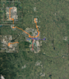
Max O.png


ReMAX Purple: Airdrie to Strathmore
, including central Airdrie, Cross Iron Mills, North Pointe, U of C, downtown, then the existing purple route with a more streamlined through run of Chestermere and on to Strathmore.
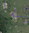
Max P.png


ReMAX Mint: Cochrane to Diamond Valley, connecting Crowfoot, Bowness, Sirocco, Westhills, Buffalo Run, Evergreen and running through Okotoks
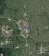
Max M.png


ReMAX Rose: Crossfield to High River, connecting east Airdrie, the airport, the 52nd St corridor (stopping at the same places as Orange, my mistake), South Health Campus and then on to Okotoks
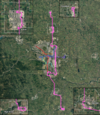
Max R.png


And then putting it all together, we would have:
Max Region All.png


Assuming half hourly frequency to start, this layout would actually result in 30 minute headways most places, but 20 minutes to Okotoks and Cochrane, and 10 minutes to Airdrie effectively.

To be slightly more practical, lines this long are really difficult to keep schedule to, and I don't know that it actually makes that much sense to do this much through-running. However, one service pattern that could make sense would be having alternate trips go out of town at each end. For example, a ReMAX Orange stop westbound on 16th Ave could have the following pattern:

From Time To
Saddletowne 8:00 Brentwood
Airdrie 8:07 Brentwood
Saddletowne 8:15 Brentwood
Saddletowne 8:22 Cochrane
Saddletowne 8:30 Brentwood (repeating)

where the regional runs alternate with in-city runs, and the buses that do regional runs only go into the region on alternate directions. It would be a little more complex to use (although we already refer to LRT lines by their end stations) and would make region-to-region trips a little slower, although to be honest, if you're on the bus that long you need a bathroom break anyways.
 

Back
Top