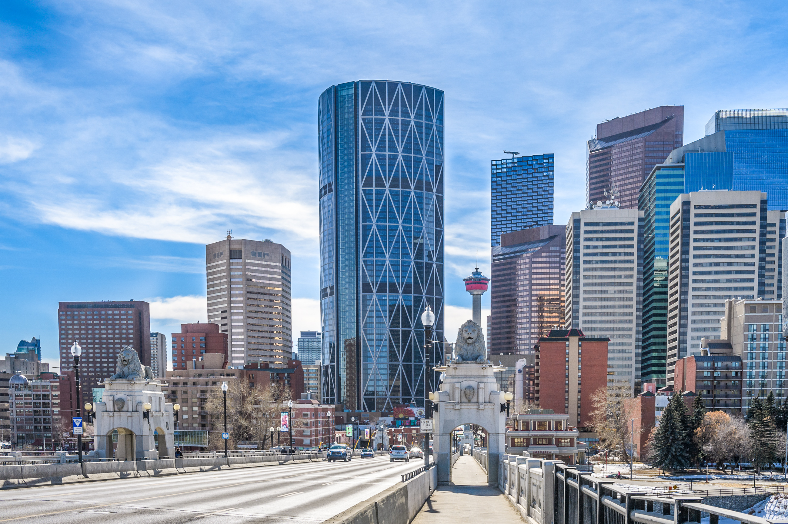
Green Line LRT | ?m | ?s | Calgary Transit

Go Elevated or try for Underground?

  • Work with the province and go with the Elevated option

    Votes: 53 75.7%
  • Try another approach and go for Underground option

    Votes: 14 20.0%
  • Cancel it altogether

    Votes: 1 1.4%
  • Go with a BRT solution

    Votes: 2 2.9%

  • Total voters
    70
The thing is, I don't think anything other than enabling work was actually approved until the end of this January so there was nothing to be leveraged. If I'm the province I'm not contributing to something that hasn't been approved. I'm not actually sure what the City was doing going ahead spending a billion dollars on all that work on something that very well could've been nothing? I know some of that money went to the design of the SE segment but still... The landfills that were remediated and all the work around Ogden would've needed to be done but not necessarily.

It is jarring how bad we got at LRT in what seems like such a short amount of time. The Blue Line west extension wasn't that long ago.
And the Blue Line is a pretty good design, but had is own issues. Here's a public audit done after construction finished, that has some interesting details - some unique, some consistent - with other projects. It didn't seem like a cheap time to build back then, but it certainly looks cheap now!

Main point - budget of $700M became about $1.3B over the life of the project, so nearly 100% cost over-run:
West LRT Audit, 2013


Original budget cost = $700M in 2007, not sure if the alignment was finalized yet:
1749583498532.png

Total actual cost ended up being ~$1.3B by 2013:
1749583612230.png

While this third table is the budget approved of about $1.4B:
1749584521526.png


A couple observations from a quick read:
  • Land: They originally had some $50M, came out to $162M. Not clear if they guessed wrong (1) or added non-LRT stuff into the land price like the new school site, the interchange land, Bow Trail expansion (2). Probably a bit of both.
  • Non-LRT stuff added in: $100M+ were scope additions were not for the LRT itself - the school rebuild, parkade at 69th Street, random Bow Trail upgrades and Sarcee Trail interchange.
    • It can be argued that some of these were "triggered" by the project, but lots are totally optional - even if it's a good idea to build the Sarcee interchange, it's not benefitting the primary project. The project would look cheaper if they didn't build the Saree Trail interchange.
  • Financing costs - this one is interesting. Essentially the Province delayed providing their grant funding due to a budget issue, causing the city to take out debt to bridge the project until the province actually sent over the money. Increased the project cost by $108M.
In summary, the West LRT project was much more expensive than thought but lots of those costs were efficiency bundling other things / pork-barreling up the project depend on if you're for or against elements of it. There was clearly political interference here too, with scope changes and financing decisions that ballooned the total cost. So some issues are similar to today.
 
Last edited:
And the Blue Line is a pretty good design, but had is own issues. Here's a public audit done after construction finished, that has some interesting details - some unique, some consistent - with other projects. It didn't seem like a cheap time to build back then, but it certainly looks cheap now!

Main point - budget of $700M became about $1.3B over the life of the project, so nearly 100% cost over-run:
West LRT Audit, 2013


Original budget cost = $700M in 2007, not sure if the alignment was finalized yet:
View attachment 657798
Total actual cost ended up being ~$1.3B by 2013:
View attachment 657799
While this third table is the budget approved of about $1.4B:
View attachment 657810

A couple observations from a quick read:
  • Land: They originally had some $50M, came out to $162M. Not clear if they guessed wrong (1) or added non-LRT stuff into the land price like the new school site, the interchange land, Bow Trail expansion (2). Probably a bit of both.
  • Non-LRT stuff added in: $100M+ were scope additions were not for the LRT itself - the school rebuild, parkade at 69th Street, random Bow Trail upgrades and Sarcee Trail interchange.
    • It can be argued that some of these were "triggered" by the project, but lots are totally optional - even if it's a good idea to build the Sarcee interchange, it's not The project would look cheaper if they didn't build the Saree Trail interchange.
  • Financing costs - this one is interesting. Essentially the Province delayed providing their grant funding due to a budget issue, causing the city to take out debt to bridge the project until the province actually sent over the money. Increased the project cost by $108M.
In summary, the West LRT project was much more expensive than thought but lots of those costs were efficiency bundling other things / pork-barreling up the project depend on if you're for or against elements of it. There was clearly political interference here too, with scope changes and financing decisions that ballooned the total cost. So some issues are similar to today.
One thing I noticed, obviously, the cost of the LRVs it didn't go up much at all. I'm sure it will be the same for the Green Line LRVs, guess there's an advantage to early procurement of those.

Nothing like some transit project scope creep to inflate the cost and make transit construction look more expensive than it really is.

The scope creep I hope for on the Green Line is +15 integration, a actual park on the land they'll need to buy at 1st and 10th coupled with a station integrated into the "High Park" parkade, and a continuous multi-use pathway along the line (even on the elevated portion).
There's tons of way smarter people that can talk through risk-transfers and procurement models and how they inflate costs for transit, but on the scope creep side of the physical infrastructure there's always lots of grey area that can easily blow up the cost - or at least not fully account for everything consistently. For example in the West LRT, it's not clear how much of land they acquired was ultimately sold off v. what was kept.

The classic is the road and utility upgrade stuff. Because you do one major mega-project, it automatically moves other projects up the priority list - because you are digging up the ground, might as well replace stuff in the area with something better.

The "trigger" on the cost may be the transit, but it quickly gets muddy because you aren't going to replace a 100-year old pipe with a similar capacity and quality one,\ -you'll upgrade capacity and in turn may trigger further upgrades for doing so. That extra costs for upgrading may be negligible or may be significant, but is often the transit "project's cost" when it's really actually just a deferred maintenance thing from the utility that hadn't gotten around to fixing it yet.

Roads on the West LRT are another example. you could have just built the LRT as is, and put Bow Trail and 17th back exactly how they were. But they also wanted to expand turn-lanes, build an interchange, increase and add merge and queue lanes all over. All that cost was a "nice-to-have", but not actually essential to the creation of an LRT line.

Sometimes they are small examples, like this comically large merge(!?) lane on 17th Ave, just west of 45th Street Station. Probably cost a few hundred grand of asphalt and is a rounding error in the project budget... small, but is totally unnecessary for LRT operation. It's 150m merge lane on a 50km/h road:

1749591009383.png


Other times they are big examples. The interchange here is very useful - it's just not necessary for the LRT to operate. Could have just constructed an LRT flyover with the project budget, then spool up a second road project budget. Boom! West LRT budget is now down 5%. That $40 or 50M could have bought another 10 LRT vehicles that would have benefitted transit:
1749591155892.png


To be clear, there's lots of good reasons to bundle stuff too - but we should always evaluate them transparently. Because transit gets tagged with the full price by critics, helping undermine the project overall like this West LRT era anti-transit hit piece that (of course) conveniently forgot the nuance here:
https://nationalpost.com/opinion/je...rys-new-lrt-should-act-as-a-warning-to-others
 
Last edited:
Not clear if they guessed wrong
On the small churches they guessed really wrong. Each ended up closer to $10 million than the less than $1 million each predicted. Likely in attempting to value the land they used market value, the market value for them as residential likely, rather than the expropriation standard, heads of compensation. Since the city would no longer let a church of those sizes be built on a similar lot with limited parking, the churches were compensated so they could buy a lot with the right zoning, and build a church with enough parking.

For the commercial properties the city would have had to both buy the properties (likely had the valuation right on the money) AND buy out the leases/extension options of the tenants. Easy to miss the lease value.

The gas station may have ended up more expensive for similar reasons. The purchase/expropriation of interests in Sunalta, hard to value that. CPR negotiations might have been more difficult than anticipated.
 
So, not a final report but hopefully something newsworthy comes out of it. Probably not as why wouldn't they just announce something if there was something to announce.
I got an email that describes the session as, "providing an update on the development of the Master Plan, and share the preliminary 30-year Network."

I assume this is the 30-year network, it is already on the website... maybe more detail will be provided?
1749745903596.png


The timeline section on the website does state, "the master plan and the 15-year delivery plan are expected to be completed by summer 2025, with the goal of informing government decisions in fall 2025 for Alberta’s Budget 2026 and future budgets."

So at best next budget there's some money for airport rail and some more in-depth work on commuter rail? At worst, partial funding and more studies.
 
Does it make sense to do separate lines from Calgary to both Lethbridge and Medicine Hat? As the crow flies Calgary to Med is about 250km; going via Lethbridge is 320km

Scenario A:
170+250 = 420km of track (crow flies; actual number higher)
Captures Brooks and Strathmore (each about 14k) and makes the Med Hat trip 20-30 mins faster

Scenario B:
320km of track
Includes service to Taber (9k), and connects the Bridge to the Hat (not sure how beneficial that is?)

Presumably a bit higher frequency with scenario B. I suppose Calgary to Lethbridge would happen first, and then they'd decide if it makes sense to extend 160km or do a totally separate 250kms (and the HWY 1 route is probably a bit 'easier')
Probably not, unless the CPR mainline is being twinned as part of an export capacity project (it should!)

When this gets consolidated into the regional rail thread, I think its good to remind everyone that a really good rail map exists. You can toggle on level crossings and mile posts, zoom in to see sidings and dual tracks and the like.

 
General question here. Has construction actually started on the Green line? I keep hearing it’s u/c but haven’t seen any pics of news showing it u/c.
 
I’m still disappointed they went with low-floor on the GL.
Low floor have some capacity restrictions. Even if the official figures are close, in reality people don't go through the narrow, wheel well sections. Are we getting significant savings with every station being smaller?
 
Low floor have some capacity restrictions. Even if the official figures are close, in reality people don't go through the narrow, wheel well sections. Are we getting significant savings with every station being smaller?
We could, I'm just not sure we will. You could build a MAX Station and call it a day, they haven't done that, to this point. Perhaps they will do that on the extensions to Seton along 52nd Street and Centre Street.
 
I’m still disappointed they went with low-floor on the GL.
I was in Kitchener for work about a month ago and since I'm a transit nerd, I rode their LRT system just for shits and giggles. It was kind of a neat system, but low-floor trains are weird.

Bad:
1. The floor is uneven. There are weird slopes in the floor, but there weren't any steps.
2. The LRT cars were a lot narrower than our LRTs.
3. The seating was odd too. Some seats were large and raised up. It gave the feel of a bus more than a metro style train.
4. There were some sections where the tracks made a 90 degree turn and the train slowed to a crawl. I cringed on this section of track. The train slowed to a crawl and then stopped for the traffic lights.
1749829336297.png


Good:
1. The system appeared well used and well connected to downtown and the Universities.
2. Travel speed didn't seem very fast. But it also didn't seem slow either. Maybe this was just due to the tri-cities being geographically smaller.
3. The stations seemed simple, easily identifiable and well integrated into the street.

1749830270450.png
 

Back
Top