


That's a good point. Though it's a really nice section of pathway, it's mainly for recreational use, whereas the pathway on the other side of the river is heavily used by commuters and is actual infrastructure. I cycle on it once in a while, but the quality of the pathway is not great for road bikes, and is also quite narrow making it tight quarters for both cyclists and pedestrians..... even kind of dangerous at times.It's a lovely stretch of path, but it's actually not a particularly 'useful' or critical part of the pathway network...I'd love to see it fixed, but from a realistic resource allocation perspective there are a lot more critical areas to address.
|
|
|
You are using an out of date browser. It may not display this or other websites correctly.
You should upgrade or use an alternative browser.
You should upgrade or use an alternative browser.
Calgary Bike Lanes and Bike Paths
- Thread starter Cowtown
- Start date
lemongrab
Active Member
I agree, but I think it would be a half-assed measure that actually prevents a better long-term solution. There is also a big base for an overhanging road sign and some guy-wires for power poles. I wonder what the cost of relocating those + 12 light poles, vs. adding a lane?Just even getting the street lights off of the pathway itself (move them to the median of the road) would help a lot in that section. It's crap the way it is right now.
Looking at it a bit more, you probably do want to keep 2 vehicle lanes on EB Parkdale (1 through lane and 1 that exits onto Crowchild), which would mean encroaching into the median (and managing stormwater).
A relatively simple but meaningful goal should be to have both wheeling lanes and pedestrian paths from downtown to at least Edworthy. A few choke points are inevitable (under Crowchild), but 20st to 16st on the east side of Crowchild has this same problem (and same possible solution). The wheeling lane would be a nice buffer from the ped lane to cars, and you take out that short stretch of 70kph.
Joborule
Active Member
For that section east of Crowchild, I would hope that section will get the cosmetic upgrade that Memorial got from 14 Street to Centre Street. Therefore the road is pushed more into the median, and the pathway section gets a bit more ROW to work with to improve the spacing, quality, and looks of that area.I agree, but I think it would be a half-assed measure that actually prevents a better long-term solution. There is also a big base for an overhanging road sign and some guy-wires for power poles. I wonder what the cost of relocating those + 12 light poles, vs. adding a lane?
Looking at it a bit more, you probably do want to keep 2 vehicle lanes on EB Parkdale (1 through lane and 1 that exits onto Crowchild), which would mean encroaching into the median (and managing stormwater).
A relatively simple but meaningful goal should be to have both wheeling lanes and pedestrian paths from downtown to at least Edworthy. A few choke points are inevitable (under Crowchild), but 20st to 16st on the east side of Crowchild has this same problem (and same possible solution). The wheeling lane would be a nice buffer from the ped lane to cars, and you take out that short stretch of 70kph.
Mountain Man
Senior Member
Just for a bit more context, I took these pictures from the other side of the river yesterday. Gives some context for how much ice builds up and how much work it would be to control.


Last edited:
adamyyc
Senior Member
Really unfortunate but totally preventable tragedy. I used this incident as a safety moment to start meetings last week.
lemongrab
Active Member
I rode this section today - it's now slushy and easy to cross, but there is definitely a signage failure. Coming from the east there is a sign at the rail crossing 200m west of the Crowchild bridge - it currently just say 'Open' for the trail heading west...which is true until the gate right after the next rail crossing, at which point I don't think there was any signage at all (just the gate across the main path). I think it was just the gate for eastbound users, too.
At that Crowchild junction they need to be more specific:
Lawrey Gardens Park: Open/Closed
Edworthy Connectore: Open/Closed - No Thru Road (Impassable Ice Flow; use pathway on north side of river)
It's over 2000 meters from that junction to the closed gate. Almost all of the dumb things I've done in the outdoors/wilderness have come from trying to take a shortcut/avoid backtracking.
Mountain Man
Senior Member
They definitely need better signage, but before covid that section of pathway was not well used. The pathway on the N side of the river is much better and is a shorter ride, but I've always preferred the trees and quiet of the south pathway, now they are equally busy on a nice day.
Chealion
New Member
That's a good point. Though it's a really nice section of pathway, it's mainly for recreational use, whereas the pathway on the other side of the river is heavily used by commuters and is actual infrastructure. I cycle on it once in a while, but the quality of the pathway is not great for road bikes, and is also quite narrow making it tight quarters for both cyclists and pedestrians..... even kind of dangerous at times.
Given just how busy the N side gets, the S side is my preferred commuting route to/from work once the glacier called June (for when it melts) is passable.
24th ave cycle lane construction basically done now. Looks good.


Mountain Man
Senior Member
Kind of reminds me of the lane on Bowness Road.
lemongrab
Active Member
It's a good route that needed cycle lanes, but I have many nits to pick here. There are 2 not-so-obvious criteria I have for evaluating bike infrastructure:
1. Can I ride it and pay as much 'attention' as I would driving a similar route? (ie. in a car you'd be on the lookout for peds/intersections/driveways, but you wouldn't be white-knuckled and covering the brake the whole time.)
A: I'd have to ride it to be sure, but it looks like a no:
- Tons of driveways, where the bike lane feels like a visitor/intruder on the car's ramp. - Intersections feel a little messy, creating a purgatory between pedestrian/vehicle status. It should be clear that cyclists have a straight-through ROW, but I can see some ambiguity for drivers to think a 'mounted cyclist doesn't have ROW in a crosswalk'. Most of the ramps into intersections look pretty smooth, but it make it a little hairy to shoulder check for a right-turning vehicle.
2. Can I comfortably tow a child in a bike-trailer?
Maybe somewhat. You really feel the bumps when towing, and that road is a little too busy to feel great about it.
So at least for me, this is the kind of infrastructure where I'd prefer to stay on the road when solo and wanting to go fast. With a trailer I'd probably take the longer way to the north.
I'd have preferred physically separated lanes at street grade for both directions on the north side; ideally eliminate left turns onto/off of a bunch of the NB streets.
CBBarnett
Senior Member
Lots of cities don't allow sloping driveways to interfere with walking or cycling pathways. That's another alternative is to change our design preference around that.It's a good route that needed cycle lanes, but I have many nits to pick here. There are 2 not-so-obvious criteria I have for evaluating bike infrastructure:
1. Can I ride it and pay as much 'attention' as I would driving a similar route? (ie. in a car you'd be on the lookout for peds/intersections/driveways, but you wouldn't be white-knuckled and covering the brake the whole time.)
A: I'd have to ride it to be sure, but it looks like a no:
- Tons of driveways, where the bike lane feels like a visitor/intruder on the car's ramp. - Intersections feel a little messy, creating a purgatory between pedestrian/vehicle status. It should be clear that cyclists have a straight-through ROW, but I can see some ambiguity for drivers to think a 'mounted cyclist doesn't have ROW in a crosswalk'. Most of the ramps into intersections look pretty smooth, but it make it a little hairy to shoulder check for a right-turning vehicle.
2. Can I comfortably tow a child in a bike-trailer?
Maybe somewhat. You really feel the bumps when towing, and that road is a little too busy to feel great about it.
So at least for me, this is the kind of infrastructure where I'd prefer to stay on the road when solo and wanting to go fast. With a trailer I'd probably take the longer way to the north.
I'd have preferred physically separated lanes at street grade for both directions on the north side; ideally eliminate left turns onto/off of a bunch of the NB streets.
Here's an example of what I am talking about from Rideau Park, sidewalk is flat but car still gets a short, ramp:
The second issue is the intersections. Again, many cities find ways to keep sidewalk and cycling lane consistent through a raised intersection, so the cars go up and down, not the other way around.
Here's an example of Ottawa where the slope of the road and height of the curb is far gentler so way less of an issue:
And of course the Netherlands where all this is figured out. Bicycles and pedestrians stay at same level and in a straight line of travel, car just rise up to their level then come down again after:
In general it's the same old story, trade-offs were made of 24 Ave that favour drivers and vehicle status quo. It's still such a big improvement so 100% support the new look, but unfortunately couldn't crack some Calgary car-oriented standards:
- Wide curve radius preserved for turning vehicles force peds and cyclists into non-straight travel paths at intersections
- Height of our curbs and slope of the road is very high and preserved so peds/cyclists have to go down to gutter then climb out to the middle of the road, then down to the gutter again (side note - I have never understood why this is so pronounced here; most cities have far shorter curves and less steep roadways even with way more precipitation than us)
- Driveway slopes prioritized over pedestrians and cyclists having a flat travel surface.
Last edited:
MichaelS
Senior Member
We do have an interesection like that in Calgary, in East Village, where the road gets raised to keep the pedestrian realm relatively flat. 8th Ave and 5th Street SE:

 www.google.ca
Google Maps
Find local businesses, view maps and get driving directions in Google Maps.
www.google.ca
lemongrab
Active Member
Yup, all of the issues have found solutions long ago, it's just a matter of priorities.
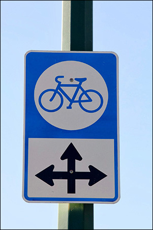
I think sometimes we are guilty of cycling infrastructure 'theatre' by trying to build as much stuff as possible that is visible/somewhat physical, when there are a lot of opportunities to create functional routes with much cheaper/simpler solutions...lots of easy ways to significantly improve the old blue sign network.
I'd rather a small amount of top-quality infrastructure + a ton of tiny improvements all over the place instead of the small-medium amount of half-assed builds we seem to get. (though I'm sure I underestimate how quick/easy the little things actually are)
Maybe a longer post later with some more detailed examples of small-tweaks, but it's mostly making some quieter roads priority-flow for bikes and limiting vehicles to local-traffic with speed humps and other traffic calming measures (islands at intersections that force vehicles to turn off but let bikes through).
Those are better, but I think pedestrians are still doing 60%+ of the 'adapting'. It's also funny to see that sandwich-board+bollard in the May-2016 streetview: "Lookout for each other! but especially you pedestrians - we can't trust drivers to obey their red octagon so we better give you a reminder+obstruction before you consider using this supposedly more pedestrian friendly crosswalk..."
Thankfully that sign and bollards are gone in the updated streetview.
I think sometimes we are guilty of cycling infrastructure 'theatre' by trying to build as much stuff as possible that is visible/somewhat physical, when there are a lot of opportunities to create functional routes with much cheaper/simpler solutions...lots of easy ways to significantly improve the old blue sign network.
I'd rather a small amount of top-quality infrastructure + a ton of tiny improvements all over the place instead of the small-medium amount of half-assed builds we seem to get. (though I'm sure I underestimate how quick/easy the little things actually are)
Maybe a longer post later with some more detailed examples of small-tweaks, but it's mostly making some quieter roads priority-flow for bikes and limiting vehicles to local-traffic with speed humps and other traffic calming measures (islands at intersections that force vehicles to turn off but let bikes through).
We do have an interesection like that in Calgary, in East Village, where the road gets raised to keep the pedestrian realm relatively flat. 8th Ave and 5th Street SE:
Google Maps
Find local businesses, view maps and get driving directions in Google Maps.
Those are better, but I think pedestrians are still doing 60%+ of the 'adapting'. It's also funny to see that sandwich-board+bollard in the May-2016 streetview: "Lookout for each other! but especially you pedestrians - we can't trust drivers to obey their red octagon so we better give you a reminder+obstruction before you consider using this supposedly more pedestrian friendly crosswalk..."
Thankfully that sign and bollards are gone in the updated streetview.
Mountain Man
Senior Member
AS a cyclist, pedestrians are easily 100x more annoying than cars, just less dangerous. Just this morning there was a couple walking down the bike lane holding hands right beside an empty sidewalk. And they both were yelling at a cyclist to use his bell when a guy passed close-ish to them. They didn't like me yell at them to use the sidewalk when I went by after lol.