DiscoStu
Active Member
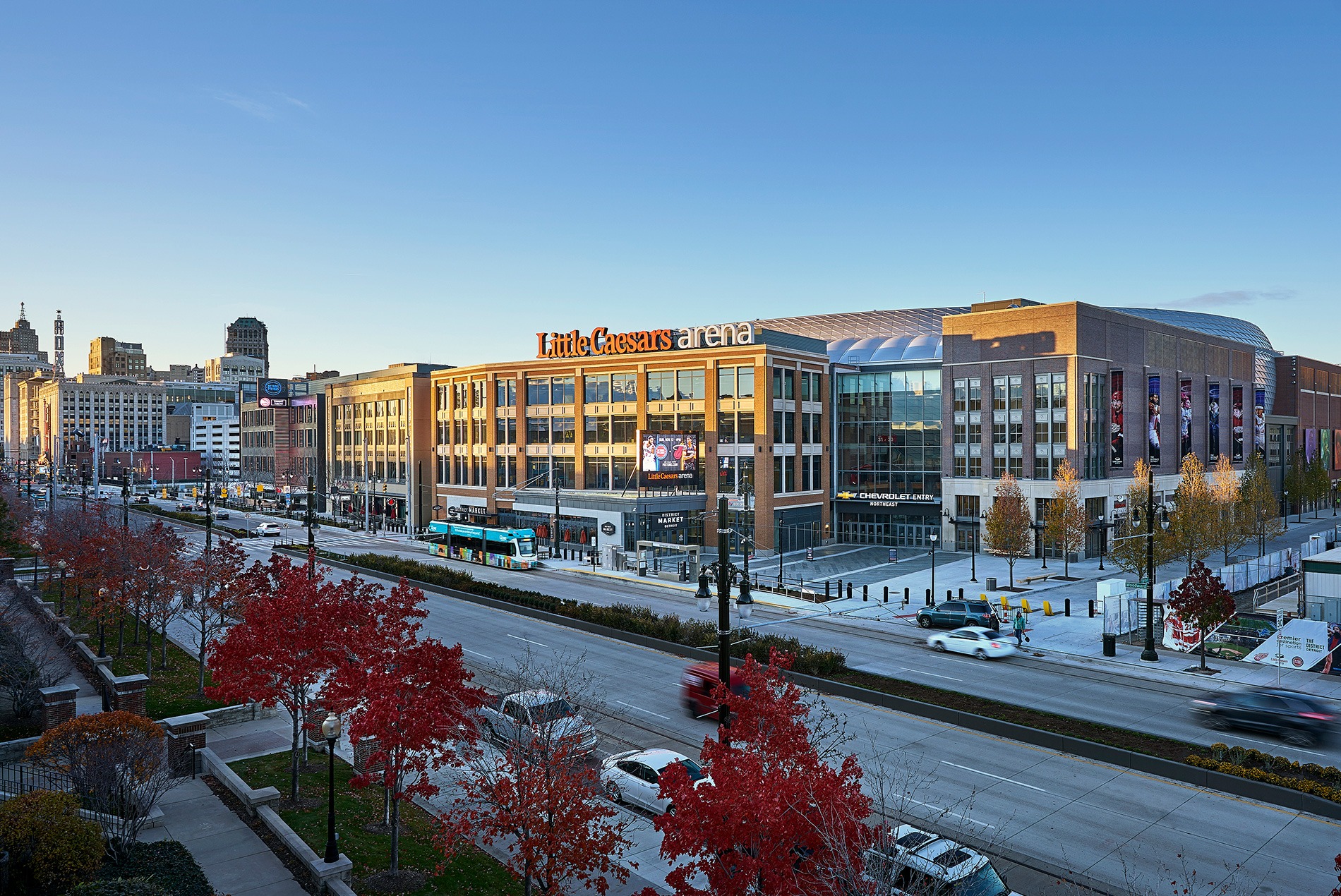
I didn't realize Little Ceasar's had a street car line adjacent to the arena. How neat would it be if we had one of these running down 12th Ave (or similar) east-west in the Beltline.
Ha I completely forgot about the "community" arena. You're right, that's what that is.Curious how you determined the office space in SE? I assumed that was the practice facility...
Well there will be the Greenline a block to the north and Red line a block or so to the west. We’ll be fineI didn't realize Little Ceasar's had a street car line adjacent to the arena. How neat would it be if we had one of these running down 12th Ave (or similar) east-west in the Beltline.
True, but neither of the train lines really serve the Beltline. Right now, our transit system puts the priority on commuting, but if society has made a non-insignificant shift away from that model, then a street-car circle loop that just focuses on getting residents around the inner-city neighborhoods would be pretty decent infrastructure investment (compared to adding onto a C-train leg in the far reaches of the suburbs). Say a loop that goes from Victoria Park>Sunalta>Lower Mount Royal>Mission....and perhaps something similar on the north side between Bridgeland and Hillhurst. Ideally nothing fancy either...no crazy overbuilt stations or bridges/tunnels.Well there will be the Greenline a block to the north and Red line a block or so to the west. We’ll be fine
Well yeah, subway is always preferred, but that's like 10x as expensive as streetcar.Seeing how people in this city can't stop getting hit by, or hitting the Ctrain, I prefer the buried subway as proposed...
A and D are great, but do they really require loops are there not streetcars you can operate from one end both ways or have a operators spot on either side?The city actually did a centre city streetcar study a while back.
I think circulators are not that great in practice. They waste a lot of time and track looping around for not a lot of benefit, IMO route A and D are the best because they serve those long corridors and would actually be useful for getting somewhere. Route A could be a single line along with the MRU streetcar
View attachment 546623
View attachment 546624
Yes. Toronto had to order their streetcars custom so they only had doors on one side and an operating cab at only one end.are there not streetcars you can operate from one end both ways or have a operators spot on either side?
True true....but on the hand... trains rule, and buses drool. Although I'm a little biased, as having to take 3 buses just to get the school in the morning (and then 3 back) for many years kinda soured me on the things for life.A bus is cheaper than a streetcar. Something to consider down the road. I just don't see the population to support a $200 million downtown streetcar loop.
Just do it you cowards, it's right in the name already!I do feel that the 17 Ave streetcar will happen at some point in the future.
")
A and D are great, but do they really require loops are there not streetcars you can operate from one end both ways or have a operators spot on either side?
I'd like to see A turn south to MRU and D go all the way to Britannia. But as has been said buses are much cheaper. Just make these frequent bus routes.
OR... Have the D route going down 4th and into Mission and then into the barley belt east of Macleod.