
 2.3K
2.3K 


It's been a while since we last caught up with Calgary's Green Line. In our last write up from April 2019, new funding had been announced for the project. Since then there has been plenty of news, but mainly relating to costs and funding. Yesterday the City of Calgary unveiled a look at some proposed designs for the north section of the Green Line, aimed at keeping the overall costs of the project down.
Original plans had the Green Line routed underground through downtown and continuing north all the way to 16th Ave N, with the line surfacing above ground around 22nd Ave N. Climbing costs however, caused the city to push the pause button on the project and consider other options.
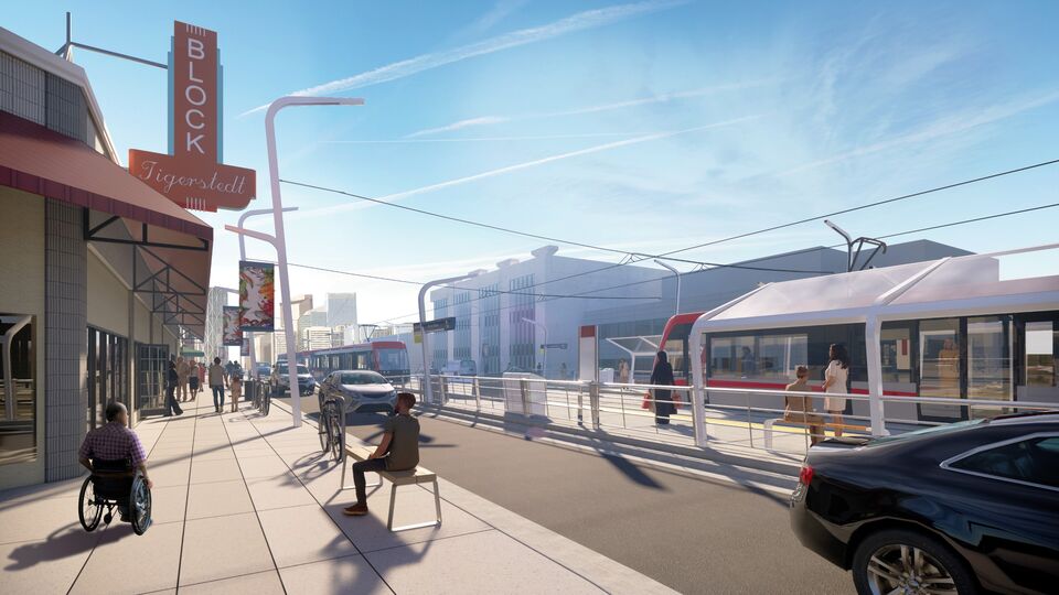
One of those options is to run the line northbound from the south through downtown as planned, but have the line surface in the Eau Claire area, use a bridge to cross the Bow River, and continue its surface route up Centre Street.The latest proposal from the city shows a surface station in Eau Claire, and 4 different styles of bridges crossing The Bow River as well as surface stations at 9th ave N and 16th N. Here are the four bridge design options the city is considering.
The next step will be more public engagement sessions through the month of March, and maybe some into April. With much, much more to come on this massive project, SkyriseCalgary will be sure to follow the progress of this project as it unfolds. For more information check out our associated database file, for photo updates or discussion check out the forum thread, and as always, feel free to leave a comments in the comment field below.


