You are using an out of date browser. It may not display this or other websites correctly.
You should upgrade or use an alternative browser.
You should upgrade or use an alternative browser.
Noble | 11m | 4s | Truman Development
- Thread starter Surrealplaces
- Start date


Attachments
Beltline_B
Senior Member
I need to get up to that part of the city more often. Where in relation to Noble is the new one with the grocery store going?
MichaelS
Senior Member
Here is a link to the approved Outline Plan:
http://www.wcdt.ca/assets/Land-Use/July-2014-Land-Use-Plan/140717-FINAL-LAND-USE-PLAN.pdf
Note that the street names listed on that plan are now out of date, and have been updated as part of the community branding as University District. For the purpose of this post though, I will use the names shown on the plan in my link, because it will just make things easier.
If I have it correct, Truman's Noble project is located on the block that is bounded by West Campus Gate and West Campus Crescent on the East and West sides respectively, and West Campus Terrace (South Side) and West Campus Grove (North Side).
Brookfield's Ivy project is located on the block to the north, bound by 32nd Ave NW, West Campus Gate, West Campus Grove, and West Campus Terrace.
The Grocery Store/Rental building project is in the SE corner of the intersection of West Campus Drive and West Campus Way (link to the DP here: https://developmentmap.calgary.ca/#property/DP2017-3969)
There is also an assisted living and condo building going in on the M-2 parcel to the west of West Campus Grove, East of Shaganappi Trail, and north of West Campus Way. Links to the two permits can be found here:
https://developmentmap.calgary.ca/#property/DP2017-4913
https://developmentmap.calgary.ca/#property/DP2017-5129
Article on the assisted living portion can be found here:
http://calgaryherald.com/business/c...g-new-seniors-facility-in-university-district
Hope that clears some things up for you.
Silence&Motion
Senior Member
This seems as good a place as any to ask this question: who is responsible for the fact all of the streets in the same neighborhoods have the same name? Also, why hasn't this person been fired and exiled from the city?
MichaelS
Senior Member
Hopefully this helps:
http://www.calgary.ca/PDA/pd/Pages/Addressing.aspx
It is a combination of the developer and the city. Much of it is actually driven by the Fire Department/Emergency Services. I believe (and could very well be wrong) that when communities started getting into the more curvilinear designs and less of a grid design, street names were meant to be similar to the community name because it allowed for fire trucks to respond faster. This seems a bit counter intuitive, given that all of the streets sound the same, but I think the idea was that at least the truck could start driving to the correct neighbourhood right away, and they could find the exact address while enroute, thus saving them time.
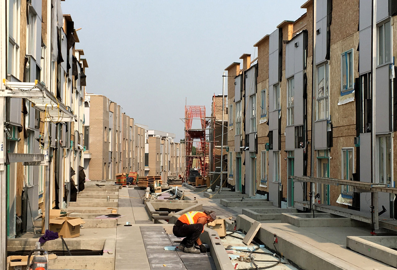
Took a stroll around University District the other day, and was impressed by Noble. It's a nice little development, and has a nice feel to it. Especially the common courtyard area.


Attachments
-
0-IMG_7351.jpg296.5 KB · Views: 836
-
IMG_7340.JPG189 KB · Views: 815
-
IMG_7341.JPG227.9 KB · Views: 541
-
IMG_7347.JPG198.7 KB · Views: 539
-
IMG_7348.JPG184 KB · Views: 522
-
IMG_7350.JPG203.4 KB · Views: 519
-
IMG_7352.JPG226.7 KB · Views: 554
-
IMG_7353.JPG196.9 KB · Views: 542
-
IMG_7356.JPG237.2 KB · Views: 552
-
IMG_7358.JPG205 KB · Views: 539
-
IMG_7359.JPG182 KB · Views: 532
-
IMG_7360.JPG183 KB · Views: 535
-
IMG_7362.JPG172.5 KB · Views: 780
Last edited:


gsunnyg
Senior Member
@Surrealplaces great pics, this one in particular looks amazing. Like something you would see in Europe with a tight narrow curving streets/alleys. Wish they made more suburban rowhomes like this, this is what real density and sense of community looks like to me!
AJX
Active Member
I got the same 'Europe' hit when I first saw the pic. I would like to see this kind of development take up an block along a street in Renfrew or Tuxedo with the alley way turned into a courtyard.@Surrealplaces great pics, this one in particular looks amazing. Like something you would see in Europe with a tight narrow curving streets/alleys. Wish they made more suburban rowhomes like this, this is what real density and sense of community looks like to me!
CCF
Active Member
Pretty marginal townhome design - some of these developers in Calgary should hit Vancouver for a primer on how to do it right.
Calgcouver
Active Member
Looks pretty good, I like the layouts here, and the skytown models they had were hitting the right prices points (high-400s). My only critique is that the colour pallet is a little neutral/bland making it feel institutional. Beige brick is a good choice, but the light silver paneling doesn't give enough contrast. I think if the paneling was a charcoal/much darker grey it would contrast with the beige brick and provide a bit more visual interest (on the townhouses/not the stacked towns). Good development overall!
Stephen Ave
Active Member
I respectfully disagree. There are tons of crap townhouses in Vancouver and they cost twice the price of these. Yeah, there are some really nice ones - if you don’t mind paying upwards of $2M for the same size unit.
Pretty marginal townhome design - some of these developers in Calgary should hit Vancouver for a primer on how to do it right.
Calgcouver
Active Member
I respectfully disagree. There are tons of crap townhouses in Vancouver and they cost twice the price of these. Yeah, there are some really nice ones - if you don’t mind paying upwards of $2M for the same size unit.
I build townhouses in Vancouver, and I think these are pretty much on par with the quality of stuff you'll typically see on Cambie Corridor. Truman knows what they are doing, and Vancouver has a lot of townhouses that are a lot worse than this.
AJX
Active Member
What's marginal about them? I like this design and the way the way they've arranged the blocks of homes. I like the materials and the rooftop patios. I haven't seen the floor plans, but from what I've seen in the pics they look fine.Pretty marginal townhome design - some of these developers in Calgary should hit Vancouver for a primer on how to do it right.