Ranchman's Village | 21m | 6s | Deveraux

MichaelS

Senior Member
Member Bio
Joined
Jul 5, 2016
Messages
3,843
Reaction score
33,551
Location
Calgary
Creating a thread for this project that was mentioned in the Urban Development thread. Nothing on DMap yet, but it should be soon.
1772148282327.png


Deveraux does this type of project quite well. Their Podium project in Medicine Hill has a pretty great little high street in it. The drawback of Macleod Trail should be offset by the nice little community this project will create for residents.
 
This is nothing special, that's for sure. I guess we can be happy about the extra density, but it's not particularly good density. Not a very walkable area, and transit along that section isn't good.
 
One way I have thought about MacLeod is that it's kind of the poster child when combining 75 years with an distinct absence of urban planning and overly strict transportation design rules for arterials.

To get started: a central problem is that the properties are both two big and too small along MacLeod - too big that each one needs a bit of a comprehensive and multi-phase approach to build anything, however never big enough to create anything that's "complete" the way that an entire neighbourhood would be designed.

Usually this is where urban planning kicks into gear as it's concerned with the orderly development of properties and integration of all properties into a coherent plan, perhaps something that lays out the networks prior to development build out, encourages subdivision of the larger parcels to reasonable blocks, focuses land uses around key nodes or corridors etc. As far as I can tell that never happened on MacLeod in any meaningful sense. This leaves each development really just doing it's own thing and never trying very hard to align to an overall vision (because it doesn't exist), and makes it next to impossible to get things right like basic connectivity and access figured out between each development and to and from the MacLeod corridor to surrounding areas.

The most serious role municipal planning ever played in development here seems to be the strict interpretation of arterial policies for MacLeod and the connecting major roads. These restrict access, force development to never front onto the street, set aside enormous right-of-ways for expansion, and limit signals and intersections. The result of this treatment of MacLeod drives all the properties to further chaotic weirdness, because they can't create anything that integrates into a grid or has a walkable frontage with the main road - it's actively discouraged along MacLeod.

In short, we missed the turn-off to have a more planned and coherent corridor about 75 years ago and have essentially seemed to be hands-off ever since so each redevelopment project continues this weird, isolated and chaotic trend.

Why it stays bad is pessimistic and defeatist attitudes and entrenchment of status quo in decision-makers: lots of views engrained out there that MacLeod Trail can never be fixed, so why even bother trying anything. So the cycle perpetuates a new development happens of serious density and opportunity, but can never be big enough to overcome the defeatist inertia and strict policy rules that keep the street the way it is. The development is then forced to be an island looking inward to itself, fails to integrate to anything, and exacerbates the problem.

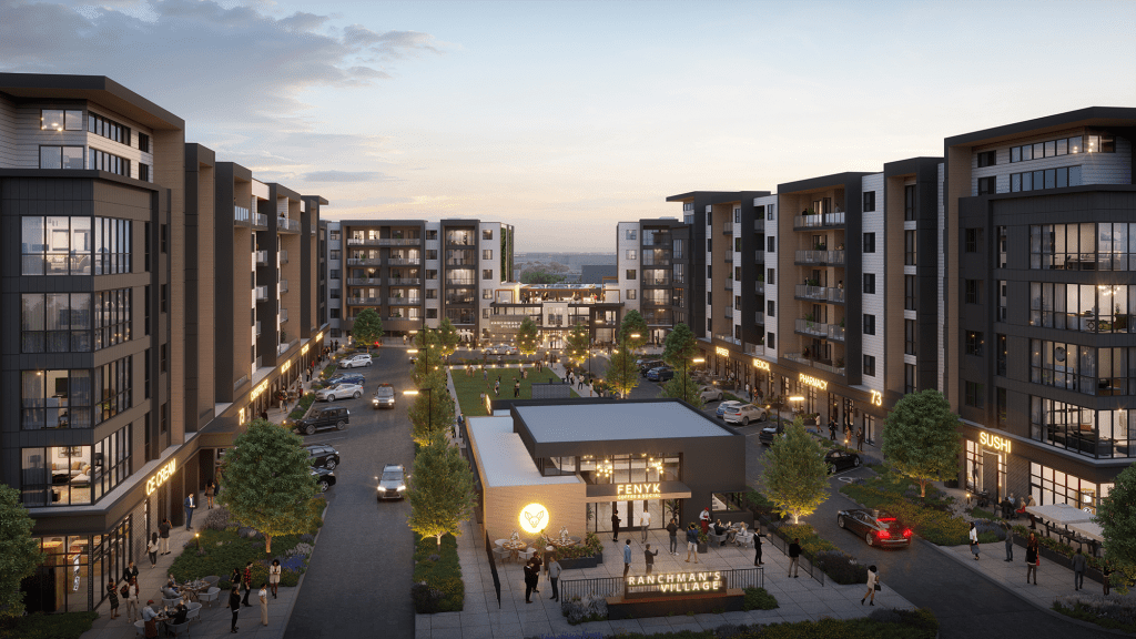
It's a stretch goal, but I'd love to see MacLeod Trail evolve into a Highway 7 in the GTA vibe (perhaps the towers are implausible, but my interest is more in how the buildings connect to the street rather than their height). Here they took an ugly MacLeod Trail corridor and made something far more organized and friendly to be on for all modes. And "war on cars" it isn't - Highway 7 didn't even try to give any of the car-orientation up (still 6 - 8 lanes + bus lanes).
1772211926360.png


Don't let those transportation engineers tell you otherwise - we don't have to live in sloppy nightmare of concrete barriers, fences, rough asphalt jobs and dirt medians. Not all car sewers have to be this dysfunctional and ugly! :)
1772211824303.png
 
Last edited:
Why it stays bad is pessimistic and defeatist attitudes and entrenchment of status quo in decision-makers: lots of views engrained out there that MacLeod Trail can never be fixed, so why even bother trying anything. So the cycle perpetuates a new development happens of serious density and opportunity, but can never be big enough to overcome the defeatist inertia and strict policy rules that keep the street the way it is. The development is then forced to be an island looking inward to itself, fails to integrate to anything, and exacerbates the problem.
It is also a case of the project being quite large, and no group willing to take it on. Again I keep harping on it, but the LAP should be the vehicle that addresses this. But other than some high level verbage written into it, no real attempt at trying to decide what Macleod Trail is going to look like is made. When asked why they are not doing this, policy planners will say it is not their department (it isn't, to be fair) and they don't have the scope to do this. However, it is not like the Infrastructure group works in parallel to ensure there is a coherent plan.

Then, you get the developers like Deveraux who come forward, attempting to meet the LAP (policy has called for this increased density along Macleod for at least 17 years, going back to the original MDP in 2009). So they are doing what the City asks. They are doing thier best to design their project to connect to Macleod as best they can, but this one project cannot fix a few kms of major roadway.
 
Does Calgary Transit even run a bus down Macleod Trail anymore? They used to run a shuttle between Chinook and Anderson but I think that stopped a few years ago.
The number 81 used to run down McLeod I don’t know if it still does. But yeah, outside of that there aren’t any bus routes. I don’t think they’re all either Elbow or Bonaventure.
 
Is there a bylaw that all new developments on Macleod must look like this?

Not just along Macleod. Virtually every 4-6 story woodframe condo being built in the city now looks exactly like this one. Black, white and grey with fake wood accents and fins. Zero originality. The present day version of a ubiquitous commie block.
 
Not just along Macleod. Virtually every 4-6 story woodframe condo being built in the city now looks exactly like this one. Black, white and grey with fake wood accents and fins. Zero originality. The present day version of a ubiquitous commie block.
I'm noticing that trend also. I'm fine with it as long as they're being built in back of busy streets and corridors, or if built along crap stroads like Macleod.
 
Not just along Macleod. Virtually every 4-6 story woodframe condo being built in the city now looks exactly like this one. Black, white and grey with fake wood accents and fins. Zero originality. The present day version of a ubiquitous commie block.
Completely against AI in architecture but at least the hallucinations would add some variety.
 
I'm noticing that trend also. I'm fine with it as long as they're being built in back of busy streets and corridors, or if built along crap stroads like Macleod.

TOD station at Douglasglen and future Caravan one along Shepard road, the Truman ones by Westbrook, the recent condos in Kingsland south of Chinook Centre, condos in Seton, old Blackfoot trailer park, probably a bunch of shit in the north of the city too. It's absolutely everywhere and all looks the SAME!
 
The number 81 used to run down McLeod I don’t know if it still does. But yeah, outside of that there aren’t any bus routes. I don’t think they’re all either Elbow or Bonaventure.
Is a bus needed? The train line runs along Macleod its entire length, and is a fairly short walk from Macleod.
 

Back
Top